

Weather by route
- Home
- Yoshida route
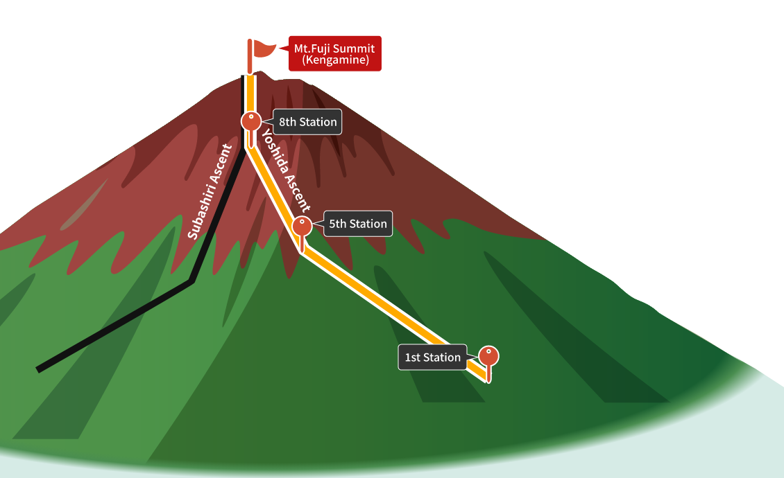
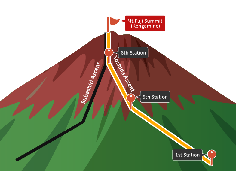
Yoshida routeObservation point
- Measured value
- Point of Reference
What is Yoshida route
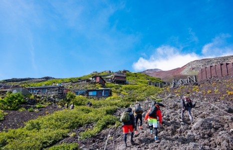
Route Characteristics
- More than half of the climbers on Mount Fuji use the Yoshida Route.
- This route is well-equipped with mountain huts.
- The ascent and descent paths are separated.
- During holidays and sunrise times, it can be very crowded, so early departure is recommended.
|
Observation Point |
Temperature |
Precipitation |
Average Windspeed |
Maximum wind gust speed |
|---|---|---|---|---|
|
Mt. Fuji summit (Kengamine) [3,776m] |
 -- mm/10min [※Non-certified product] |
-- km/h |
-- km/h |
|
|
8th Station [3,075m] |
0.0 mm/10min [※Non-certified product] |
9.0 km/h |
16.6 km/h |
|
|
5th Station [2,231m] |
10.6 ℃ |
0.0 mm/10min [※Non-certified product] |
-- km/h |
-- km/h |
|
1st Station [1,042m] |
15.1 ℃ |
0.0 mm/10min |
1.4 km/h |
6.0 km/h |
- Measured value
- Point of Reference
View weather information in graphs
After the page transition, please switch to the Fujinomiya route.Yoshida route